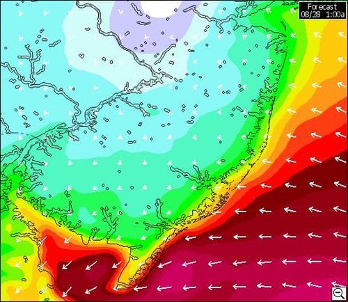
I downloaded Saiflow’s models for the next 24 hours for New Jersey. Here is a sequence starting from early am through tomorrow evening. They are models so take them with a grain of salt.
The wind velocity is ugly but may not be above a Category 1(I hope less). The really scary thing about this storm is how slow it’s moving. It’s big, fat and lumbering. The worrying thing is how wave height and speed will build over that period. The longer the wind blows at high speed, the bigger the seas and the more viloent the waves. Even today there are high winds predicted offshore this afternoon. The concern about the damage this storm could do along the shore should not be underestimated.


What causes that huge change between 1pm and 5pm? Why would the winds suddenly increase like that as the hurricane passes north and the wind shifts to the west. And from across the land too?
I looked at the same thing for my location and there’s a similar change there. Is it real or some aberration from the computer models?
I think that’s the eye of the storm passing through, hence the wind changes direction too
Just looked at my data again and the huge discontinuity is because of a change late tomorrow from the WRAMS model (which is the WeatherFlow short term forecast that has a temporal resolution of one hour and various spatial resolutions as fine as 2km) and the NAM 12km model which is run by NOAA. I assume that explains the big change in your forecasts too.
I do hope that the WRAMS model is more accurate!
Is it really supposed to be blowing that hard still at 5 pm from the West? I was expecting to have been back down to the boat to survey the hopefully minimal damage and gone home by then. Wish they had a dock cam at the State Marina.
The WRAMS model for NJ for 5pm Sunday is now available on Sailflow and, as I suspected, it predicts strong westerlies out on the ocean but much lower winds inland and along the shore. I suspect the chart for 5pm in this post is from the NAM model and is very misleading for winds over the land. (At least I hope so!)
The winds right now are around 10-15 kts inland. Definitely lower than projected yesterday. Their current forecast for 4 pm seems about right.
As projected there was a lull late morning then the wind picked up again.
Sounds like Raritan yacht club faired ok except one yacht that broke her mooring and ended against the railroad bridge. Cadence would have ben in her potential path. Very sorry for the owner but glad we hauled
We hope you survived well and didn’t have too much trouble from Irene in your neighborhood.
4 pm ended up being when the big tree came down next to my car……