I don’t normally do press release but this was too cool not share. If you haven’t checked this out, word of warning, set aside a lot of time. I get lost in this thing for hours:
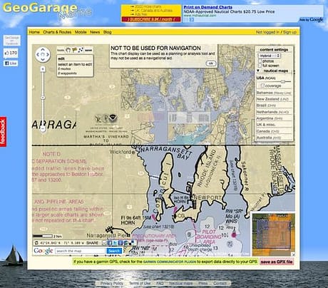
Marine GeoGarage ushers in a new era of nautical mapping services with the launch of its marine charts portal, built on Cloud Computing technology.
<http://marine.geogarage.com/routes>
The web site is the world’s first online nautical map service allowing to display maps coming from different international Hydrographic Services.
Today the catalogue of charts regroups all the ‘public raster charts’ from :
NOAA (USA), DHN (Brazil), Linz (New Zealand), SHN (Argentina), Wavey Line (Bahamas), NLHO (Netherlands)
Marine GeoGarage’s web interface also gives site visitors viewing access to all ‘private raster charts’ from :
UKHO (UK, Belgium, Netherlands, Croatia, Oman, Portugal, Spain, Iceland, South Africa, Malta), CHS (Canada), AHS (Australia)
accessible via some monthly ‘Chart Premium’ subscription (9.9 ?/month).
Today more than 3850 electronic charts are available in the GeoGarage servers; additional layers are in preparation.
The big advantage is that all the layers are kept updated regularly so the user is sure to visualize recent documents.
But the web site is not only a seamless chart viewer overlaying charts at different scales on aerial and satellite imagery from Google Maps.
It also allows the user to plot waypoints and to prepare some navigation routes which can be saved in his account after free registering and uploaded to GPS (in gpx format or directly to Garmin GPS via its Communicator web plugin).
Some universal iPhone/iPad applications tied to the GeoGarage are also available on the AppStore :
<http://marine.geogarage.com/mobile>


Geeze. I can plot a route from my back door to my wife’s rhubarb patch!
Seriously. How cool is it that you can see her rhubarb from space?
Now that sounds like a punchline from the Two Ronnies!
Checked out the tool its simply the best. Thanks for sharing very helpful. Bookmarked!
The site is not only a picture viewer transparent overlay maps of different scales of aerial photographs and satellite images of Google Maps.